Recent Storm Damage Posts
Staying Safe in a Tornado
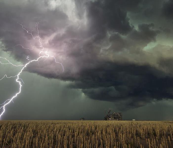
4/25/2024 (Permalink)
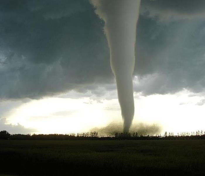 Tornado touching ground
TIP ?: Be prepared.
The best way to stay safe during a tornado is to be prepared with the following items:
- Fresh batteries and a battery-operated TV, radio, or internet-enabled device to listen to the latest emergency weather information
- A tornado emergency plan including access to a safe shelter for yourself, your family, people with special needs, and your pets
- An emergency kit (including water, non-perishable food, and medication)
- A list of important information, including telephone numbers
Be sure your children know what a tornado is, what tornado watches and warnings are, what county or parish they live in (warnings are typically issued by county or parish), and what makes a location a safe shelter, whether at home or at school.
TIP ?: Stay aware of weather conditions.
To protect yourself and your loved ones from harm during a tornado, pay close attention to changing weather conditions in your area. If you know thunderstorms are expected, stay tuned to local radio and TV stations or a NOAA weather radio station for further weather information. Some tornadoes strike rapidly without time for a tornado warning. The following weather signs may mean that a tornado is approaching:
- A dark or green-colored sky
- A large, dark, low-lying cloud
- Large hail
- A loud roar that sounds like a freight train
If you notice any of these conditions, take cover immediately, and stay tuned to local radio and TV stations, a NOAA weather radio station, or the internet.
TIP ?: Know where to shelter.
Falling and flying debris causes most injuries and deaths during a tornado. Although there is no completely safe place during a tornado, some locations are much safer than others.
- Go to the basement or an inside room without windows on the lowest floor (bathroom, closet, center hallway).
- If possible, avoid sheltering in any room with windows.
- For added protection get under something sturdy (a heavy table or workbench). Cover your body with a blanket, sleeping bag or mattress. Protect your head with anything available.
- Do not stay in a mobile home.
If you are outside or in a mobile home, find a nearby building, preferably with a basement. If you are in a car, do not try to outrun a tornado, but instead find the nearest sturdy building.
No one can know a tornado’s strength before it touches down, so keep up with local weather information, especially when thunderstorms are forecasted. Prepare your home and family for the possibility of a tornado. Moving to a shelter quickly is easier when everyone knows where to go, whether in your home or outdoors. Following these tips will give you the best chance for staying safe.
CDC.GOV
Tornado Safety
5/1/2023 (Permalink)
 Spring is Tornado Season
Tornado Safety
Keeping informed about the weather is the best way to avoid being caught in a tornado or severe thunderstorm. Your local National Weather Service Forecast Office provides information about dangerous weather in your area, and you should keep a close eye on this information whenever storms threaten your area. A battery operated NOAA Weather Radio with a warning alarm feature should be a part of your information system!
It’s also critical that you think about tornado safety long before there’s a storm on the horizon, and plan what you will do to stay safe no matter where you may be when storms threaten.
When a severe storm or tornado threatens, remember these basic guidelines:
GET IN - get as far inside a strong building as you can, away from doors and windows
GET DOWN - get to the lowest floor
COVER UP - use whatever you can to protect yourself from flying or falling debris
- A reinforced underground storm shelter, storm cellar, enclosed basement or safe room are usually the safest places in a tornado. Underground shelters get you out of the way of flying and falling debris, which is a tornado’s most lethal weapon.
- If you cannot get underground, remember the basic guidelines. Get as far inside the strongest building you can find. Stay away from doors, windows and other openings to the outside. Put as many walls between you and the outside as you can.
- Get as low as you can. Go to the lowest floor of the building you’re in.
- Cover up to protect yourself from flying and falling debris. Use whatever you can find - pillows, blankets, sleeping bags, mattresses. Wearing a helmet or hardhat will help protect your head from debris.
- Being outdoors, in a mobile home, or in a vehicle are all unsafe in a tornado or severe thunderstorm. Find stronger shelter before the storm arrives and remember to get in, get down and cover up.
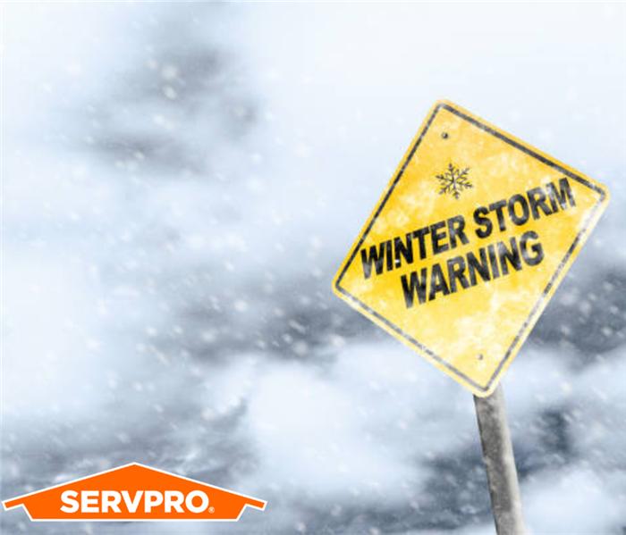
Preparing for a Winter Storm
1/2/2023 (Permalink)
 To keep yourself and your loved ones safe, you should know how to prepare your home and your car before a winter storm hits.
Make a Plan
Be prepared before a winter storm hits by planning ahead. If you are in an area prone to winter weather, be sure to create a communication and disaster plan for your family ahead of time.
Weatherproof your home.
- Insulate any water lines that run along exterior walls so your water supply will be less likely to freeze.
- Caulk and weather-strip doors and windows.
- Insulate walls and attic.
- Install storm or thermal-pane windows or cover windows with plastic from the inside.
- Repair roof leaks and cut away tree branches that could fall on your home or other structure during a storm.
Have your chimney or flue inspected each year.
If you plan to use a fireplace or wood stove for emergency heating, have your chimney or flue inspected each year. Ask your local fire department to recommend an inspector or find one online.
Featured ResourceCheck out our infographic, Be Ready! Winter Weather for tips on getting your family, home, and car ready for a winter storm.
pdf iconMore >Install a smoke detector and a battery-operated carbon monoxide detector.
- If you’ll be using a fireplace, wood stove, or kerosene heater, install a smoke detector and a battery-operated carbon monoxide detector near the area to be heated. Test them monthly and replace batteries twice a year.
- Keep a multipurpose, dry-chemical fire extinguisher nearby.
- All fuel-burning equipment should be vented to the outside.
- Each winter season have your furnace system and vent checked by a qualified technician to ensure they are functioning properly.
For older adults, keep an easy-to-read thermometer inside your home.
If you or a loved one are over 65 years old, place an easy-to-read thermometer in an indoor location where you will see it frequently. Our ability to feel a change in temperature decreases with age. Older adults are more susceptible to health problems caused by cold. Check the temperature of your home often during the winter months.
Create an emergency car kit.
It is best to avoid traveling, but if travel is necessary, keep the following in your carexternal icon:
- Cell phone, portable charger, and extra batteries
- Items to stay warm such as extra hats, coats, mittens, and blankets
- Windshield scraper
- Shovel
- Battery-powered radio with extra batteries
- Flashlight with extra batteries
- Water and snack food
- First aid kit with any necessary medications and a pocket knife
- Tow chains or rope
- Tire chains
- Canned compressed air with sealant for emergency tire repair
- Cat litter or sand to help tires get traction, or road salt to melt ice
- Booster cables with fully charged battery or jumper cables
- Hazard or other reflectors
- Bright colored flag or help signs, emergency distress flag, and/or emergency flares
- Road maps
- Waterproof matches and a can to melt snow for water
Oklahoma - Tornado Alley
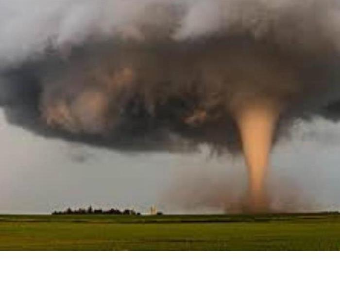
3/22/2021 (Permalink)
 Tornado touching down in Oklahoma
Oklahoma has a history of violent weather and Oklahoma produces more Tornadoes per year than other state in America. For this, Oklahoma is known as Tornado Alley. According to the National Weather Service, in 2019, Oklahoma broke the record for Tornadoes in a year with 146, 10 of those in our Mayes and Wagoner Counties area alone.
Defined by the National Weather Service, - a Tornado is a violently rotating column of air extending from the base of a thunderstorm down to the ground. Tornadoes can destroy well-made structures, uprooting trees, and hurling objects through the air like deadly missiles. Tornadoes can occur at any time of day or night and at any time of the year. Although tornadoes are most common in the Central Plains and the southeastern United States, they have been reported in all 50 states.
Tornadoes typically occur during the spring and early summer months in Oklahoma, however Tornadoes can happen any time of the year.
Since 1999 Wagoner County has had 34 reported Tornadoes and Mayes County has had 44 reported Tornadoes. Towns that have seen significant damage due to high winds include; Coweta, Broken Arrow, Wagoner, Okay, Porter, and the Fort Gibson Lake Area in Wagoner County and Pryor, Chouteau, Mazie, Locust Grove, Salina, Adair, Langley, Rose, Spavinaw, and the South Grand Lake Area in Mayes County.
The most resent Tornadic activity in our area was in 2020, when the Salina / Locust Grove area was hit by an EF1 Tornado with damage around the Hudson Lake area. Damage included uprooted trees, some roof damage and hail.
The most significant Tornado activity for our Mayes and Wagoner County area was in 1942 when and EF4 Tornado struck Pryor. This tornado touched down 5 miles south of Claremore at about 3:15 pm CST and moved east-northeast through rural parts of Rogers and Mayes Counties before taking aim on Pryor.
At 3:45 pm CST, the tornado entered Pryor and traveled directly through the main portion of the town, including the principal business section. Its violent winds demolished dozens of frame buildings and several brick buildings, including the First Baptist Church. After leaving Pryor, the tornado caused damage to the northeast of the town, completely wrecking everything in its path before it lifted about 3 miles northeast of Pryor. The damage swath was a quarter of a mile in width, and about a third of Pryor was destroyed by the tornado including much of the downtown.
Torrential rains accompanied the tornado and water knee deep surged down the main street. Communication and power lines were wiped out completely for 16 miles around Pryor and floodwaters interfered greatly with relief and rescue work and resulted in the closing of some of the highways leading into the city.
A total of 49 people were killed in Pryor, with another 3 persons killed to the west-southwest of the town. A total of 350 people were injured with 192 of those being hospitalized. Damages totaled $2.3 million and 500 buildings were damaged or destroyed. In 2021 money, the damage total would be over $32 million.
Here are some tips and things to know about preparing for Tornado season.
KNOW THE DIFFERENCE
- Tornado Watch: Be Prepared! Tornadoes are possible in and near the watch area. Review and discuss your emergency plans and check supplies and your safe room. Be ready to act quickly if a warning is issued or you suspect a tornado is approaching. Acting early helps to save lives! Watches are issued by the Storm Prediction Center for counties where tornadoes may occur. The watch area is typically large, covering numerous counties or even states.
- Tornado Warning: Take Action! A tornado has been sighted or indicated by weather radar. There is imminent danger to life and property. Move to an interior room on the lowest floor of a sturdy building. Avoid windows. If in a mobile home, a vehicle, or outdoors, move to the closest substantial shelter and protect yourself from flying debris. Warnings are issued by your local forecast office. Warnings typically encompass a much smaller area (around the size of a city or small county) that may be impacted by a tornado identified by a forecaster on radar or by a trained spotter/law enforcement who is watching the storm.
BE PREPARED
- Check the forecast. Listen to local news station on the TV, Radio, or a NOAA Weather Radio station to stay informed about tornado watches and warnings. Check the Weather-Ready Nation for tips. If storms are in your area, watch for darkening skies, lightning, increasing winds.
- If you have a smart phone, check your weather app on your phone or download a weather app to stay informed.
- Look for community pages on social media such as your local Emergency Management.
- Get a battery operated or hand crank radio to stay informed if the power goes out. (Look for one with a phone charger on it).
- Get an emergency kit, that includes first aid materials. You can find these at most retail stores in your area.
- Secure outdoor objects that could blow away or cause damage, such as trampolines, outdoor grills and lawn furniture.
- Create a Communications Plan: Have a family plan that includes an emergency meeting place and related information. If you live in a mobile home or home without a basement, identify a nearby safe building you can get too quickly, such as a church or family member.
- Pick a safe room in your home, such as a basement, storm cellar, or an interior room on the lowest floor with no windows. Check more ideas for your family plan at: https://www.ready.gov/make-a-plan
- Practice Your Plan: Conduct a family severe thunderstorm drill regularly so everyone knows what to do if a tornado is approaching. Make sure all members of your family know to go there when tornado warnings are issued. Don't forget pets if time allows.
- Prepare Your Home: Consider having your safe room reinforced. You can find plans for reinforcing an interior room to provide better protection on the Federal Emergency Management Agency website.
DURING A TORNADO
- Stay Weather-Ready: Continue to listen to local news or a NOAA Weather Radio to stay updated about tornado watches and warnings.
- At Your House: If you are in a tornado warning, go to your basement, safe room, or an interior room away from windows. Don't forget pets if time allows.
- At Your Workplace or School: Follow your tornado drill and proceed to your tornado shelter location quickly and calmly. Stay away from windows and do not go to large open rooms such as cafeterias, gymnasiums, or auditoriums.
- Outside: Seek shelter inside a sturdy building immediately if a tornado is approaching. Sheds and storage facilities are not safe. Neither is a mobile home or tent. If you have time, get to a safe building.
- In a vehicle: Being in a vehicle during a tornado is not safe. The best course of action is to drive to the closest shelter. If you are unable to make it to a safe shelter, either get down in your car and cover your head or abandon your car and seek shelter in a low-lying area such as a ditch or ravine.
- Stay safe, do not go storm chasing, leave that to the professionals.
AFTER A TORNADO
- Continue to listen to local news or a NOAA Weather Radio to stay updated about tornado watches and warnings. Multiple rounds of thunderstorms capable of producing tornadoes are possible during severe weather outbreaks.
- Contact Your Family and Loved Ones: Let your family and close friends know that you're okay so they can help spread the word. Text messages or social media are more reliable forms of communication than phone calls.
- Assess the Damage: After the threat for tornadoes has ended, check to see if your property has been damaged. When walking through storm damage, wear long pants, a long-sleeved shirt, and sturdy shoes. Contact local authorities if you see power lines down. Stay out of damaged buildings. Be aware of insurance scammers if your property has been damaged.
- Help Your Neighbor: If you come across people that are injured and you are professionally trained, provide first aid to victims if needed until emergency response teams arrive.
- Stay safe, do not go storm chasing, leave that to the professionals.
SERVPRO® of Mayes and Wagoner Counties specializes in Fire and Water Cleanup and Restoration.
If you have any questions, call your SERVPRO® of Mayes and Wagoner Counites, 918-486-1055. 24/7 Emergency Response.
Emergency numbers for our Mayes and Wagoner Counites Area to keep handy.
Oklahoma Natural Gas (ONG) – 800-664-5464 GRDA (Electric) – 918-256-5545 PSO (Electric) - 1-888-218-3919
Wagoner County Emergency Management – 918-279-0059
Wagoner County Sheriff Department – 911 or Non-Emergency 918-485-3124
Coweta Fire Department – 911 or Non-Emergency 918-486-2121 Coweta Police Department – 911 or Non-Emergency 918-486-2121
Coweta Water Department – 918-486-2189
Wagoner Fire Department – 911 or Non-Emergency 918-485-8082 Wagoner Police Department – 911 or Non-Emergency 918-485-9564
Wagoner Water Department - 918-485-4586, Ext. 237
Porter Fire Department - 911 or Non-Emergency 918-483-2521 Porter City Hall / Utilities – 918-483-8331
Mayes County Emergency Management – 918-825-4650
Mayes County Sheriff Department - 911 or Non-Emergency 918-825-3535
Chouteau Fire Department – 911 or Non-Emergency 918-476-8928 Chouteau Police Department - 911 or Non-Emergency 918-476-5225
Chouteau City Hall / Utilities – 918-476-5902
Pryor Fire Department - 911 or Non-Emergency 918-825-4650 Pryor Police Department - 911 or Non-Emergency 918-825-1212
Pryor City Hall / Utilities – 918-825-0888
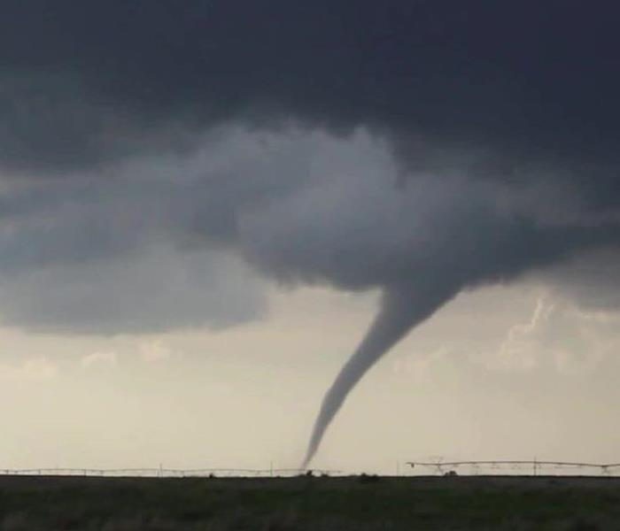
Thunderstorm Preparedness for Oklahoma
1/4/2021 (Permalink)
 Thunderstorm moving in over wheat field.
Because of the location of Oklahoma, the state sees more major thunderstorms per year than nearly any other state.
Thunderstorms can be a beautiful site but are very unpredictable and can cause severe damage to your home, business, and property in a mater of minutes without any warning.
Thunderstorms normally occur during the evening or night but can happen at any time of the day. Most Thunderstorms include lighting and often include high winds over 50 MPH, hail, can cause flash floods and especially in Oklahoma, they can cause tornadoes.
Remember that thunderstorms are serious. In the United States, lighting from thunderstorms kill over 300 people a year and injure another 80.
Here are some tips to be prepared for Thunderstorms.
Preparing for a Thunderstorm and Lightning
- Familiarize yourself with the terms that are used to identify a thunderstorm hazard, including understanding the difference between a severe thunderstorm watch and a severe thunderstorm warning.
- A thunderstorm watch means there is a possibility of a thunderstorm in your area.
- A thunderstorm warning means a thunderstorm is occurring or will likely occur soon. If you are advised to take shelter so immediately.
- Get anemergency supply kit. You can find these at most retail stores in your area.
- Remove dead or rotting trees and branches that could fall and cause injury or damage during a severe thunderstorm.
- Use the 30/30 lightning safety rule. If you see lightning and you cannot count to 30 before hearing thunder, go indoors. Then stay indoors for 30 minutes after hearing the last clap of thunder.
Have a Thunderstorm Plan
- If a thunderstorm is likely in your area, postpone outdoor activities.
- Secure outdoor objects that could blow away or cause damage, such as trampolines, outdoor grills and lawn furniture.
- Avoid showering or bathing during a thunderstorm. Plumbing and bathroom fixtures can conduct electricity.
- Watch for darkening skies, lightning, increasing winds.
- Go quickly inside a home, building, or hard top automobile, if possible.
- If an underground shelter is available go there.
- If shelter is not available go to the lowest area nearby and make yourself the smallest target possible but do not lie flat on the ground.
- If on open water, get to land and shelter immediately.
- Things to avoid include:
- Tall, isolated tree in an open area.
- Hilltops, open fields, the beach, a boat on the water, isolated sheds, or other small structures in open areas.
- Stay away from anything metal, such as tractors, farm equipment, motorcycles, golf carts, golf clubs, and bicycles
Stay Informed
- Tune into your local news station on the TV or radio.
- If you have a smart phone, check your weather app on your phone or download a weather app to stay informed.
- Look for community pages on social media such as your local Emergency Management.
- Get a battery operated or hand crank radio to stay informed if the power goes out. (Look for one with a phone charger on it).
Be Aware
- A corded telephone should only be used in an emergency, but cordless phones and cell phones are safe to use.
- Avoid potential flooded roads. Just six inches of water can knock a person off their feet and up to one foot of moving water can push your car off the road.
- Stay safe, do not go storm chasing, leave that to the professionals.
SERVPRO® of Mayes and Wagoner Counties specializes in Fire and Water Cleanup and Restoration.
If you have any questions, call your SERVPRO® of Mayes and Wagoner Counites, 918-486-1055. 24/7 Emergency Response.
Thunderstorm Preparedness in Oklahoma
1/31/2020 (Permalink)
Thunderstorms are beautiful, but they can also be dangerous. They can cause severe damage to your home and property in Oklahoma. Thunderstorms include lightning and can:
- Include winds over 50 MPH
- Create hail
- Cause flash floods
- Cause tornadoes
In most places, a thunderstorm can happen at any time of the year and at any time of the day.
SERVPRO® of Mayes & Wagoner Counties knows you cannot prevent a thunderstorm, but you can prepare:
- Know the risk for thunderstorms in Oklahoma
- Sign up for your community’s warning system
- Cut down or trim trees that may fall on your home or office
- Install surge protectors, lightning rods, or a lightning protection system
SERVPRO of Mayes & Wagoner Counties repeats the warning, “When thunder roars, go indoors.” You don’t have to wait for the thunder. If there is a thunderstorm warning, go inside. Once there:
- Unplug appliances
- Do not use landline phones in office or home
- Pay attention to alerts and warnings
If you can’t get inside a building:
- If you are swimming or in a boat, get to land immediately. Find shelter
- If you are in a car, don’t touch anything metal
- “Turn around. Don’t Drown. '' Avoid flooded roads. 6 inches of moving water can knock you down. One foot of moving water can sweep away your car.
A lightning strike during a thunderstorm can leave a wake of destruction in its path. This can range from minor electrical issues to fire damage. Lightning is also a major cause of injury or death from weather-related dangers. Most people survive being hit by lightning, but they often have long-term problems.
SERVPRO of Mayes & Wagoner Counties is independently owned and operated.


 24/7 Emergency Service